Lobositz
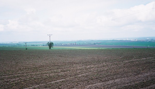
This shot was taken from the Austrian side of the field from just above the Morellen- Bach. There is a drop of several meters to what, pre-drainage, must have been very boggy ground; now the Morellen - Bach is allotments. The drop is steep - definitely a good place to form a defencive line. Across the valley is the Homolka Mound (left) and the Lobosch (right).
Across the Holmolka Mound from just above Wchinitz.
From the Homolka Mound: The Lobosch. The valley between the two is where Frederick deployed the bulk of his 10,000 cavalry.In this photo, they charged from left to right. It is great cavalry ground.
From the Homolka Mound: The town of Lobositz. In the mid distance (centre left), just above the strip of white buildings, is the Elbe.
From the Homolka Mound: The southern end of the field. I believe that the built up area in front of the industrial complex is Sullowitz.
Myself and Mark Dudley on the Homolka Mound. In the far distance, more volcanic mounds - any battle around these parts would probably feature one.
From the edge of Wchinitz: The valley between the Homolka and Lobosch opens out onto a very flat plain. It must have been quite something, 10,000 cavalry moving forward on that misty morning.
....and that volcanic mound really is quite an inspiring battlefield feature. This was one of the best visits to an unexploited (no museum, etc. - not that that is a good thing) battlefield that I've ever made. From the Homolka especially, you can 'see it all happening'.
Kolin
From the top of the slope - looking towards Brzistwi. The tops of the trees you can see are in a short steep sided gorge.
These are the 30 Years War earthworks that must have been used by the Austrians and might explain why they were able to hold the Prussians so easily.
From the earthworks looking down towards the Kaiser Strasse: It is definately higher, definitely a superior position from which to view the enemy, but it is not a slope that would impede movement. What a killing ground.
More earthworks running around the church at Krezechorz.
The church.
The Kolin Monument. I can't rotate the thumbs on the disk.
Currently, my brother-in-law is living in Prague. I intend to revisit Kolin, next year perhaps. This trip was fleeting - perhaps an hour or so - and it left me uninspired. More exploring next time; next time without the (very bored) ladies.
BTW, Chotusitz is also in the area and we went there on route to Kolin. You can see Chirkwitz Pond from the main road, but the rest is covered by a secured military airbase - can assume that it was always billiard table flat? This is one you should, if you have limited time, miss.


4 comments:
Cheers! Thanks for sharing. Tried playing both those battles at various times.
Thanks for these. Next best thing to being there.
FMB
I will be visiting both battlefields in a few weeks with three fellow Seven Years War members. I was there with Duffy in 1994. Thanks for the pictures.
Ken Bunger
Thanks for digging those out. I did a refight of Lobositz a few years ago at the Colours show. That view across the Morellen-Bach is invaluable - as you say, it really brings out the advantage of the position for the Austrians.
Post a Comment